Saturday, March 19, 2016

Some where to taumarunui

Some where to taumarunui

I'm pack and on the trail early first heading across the big brige that I camp near last night  then a mix of different types of trail that lead to the mid point on the trail  (the doc camp site where I spent new year eve 2015-2016 at on the way north (i went south from te kuiti to taumarunui before heading north up to Cape reinga so I could do the timber trail and parts of the river trails as a test run for doing the tour Aotearoa route)   I did think of having a short day and staying at the doc camp ground but decide to just keep riding to taumarunui (or where ever I end up when it gets dark : )

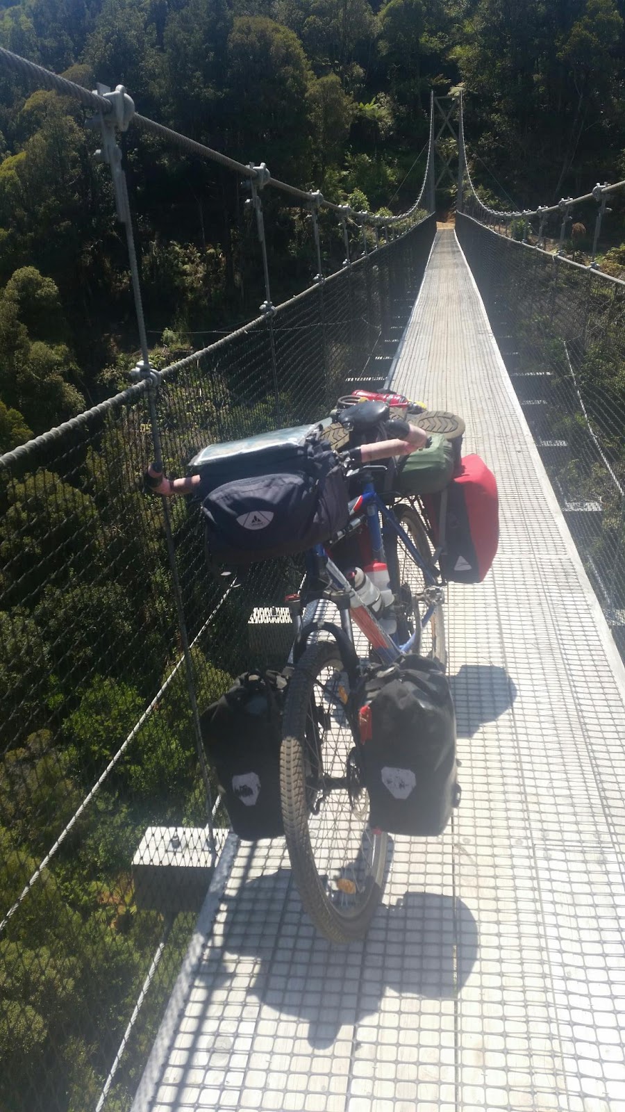
From the doc camp site the timber trail climbs up towards the end of one of the bush tramlines crossing over the largest bridge on the timber trail along the way - from the end of the old bush tramline the trail heads down hill. I keep riding until I get to the ongarue spiral  where after trying to do a video of riding around the spiral (didn’t work) I headed back and just did photos of the spiral (what did work : )    - the ongarue spiral was built as part of the bush tramline so the trains could make the climb up the hill (to lessy out the grade of the climb)  then it's on to the end of the timber trail at ongarue.

From ongarue  the tour Aotearoa route heads along a mix of gravel and tarseal back roads to taumarunui where I get some food before heading out of town to the camping ground what's about 5 km south of town for the night

Some where to some where else (on the timber trail : )

Some where to some where else (on the timber trail : )

After packing up camp it's back on the trail riding to mangakino where I do a bit of shopping to replace a drink bottle (lost some where on the trail yesterday ) - after asking at the library about water (where I have a bit of a chat to the nice person there about my route and my ride- who let's me full up on water as my next chance to full up on water that I know of will be some where on the timber trail

 then it's back on the river trail (stopping at the bus stop café for a bit of a chat to some people for a bit ) until I get to where the ta ride notes say to turn off (big thanks to the person (you know who you are : ) who spent a lot of they own time doing ride notes for the tour Aotearoa route - It made my ta ride so much easier knowing where to go and when to turn to stay on Route ) heading a hill I get to what looks to be a locked gate where I would have to unload the bike to get over - luckily it only looks locked then it's on to a fun mix of tarseal and gravel back roads that lead to a road end where there is a rough 4wd? Track down a hill to a old very norow swing bridge (on the site of a logging road  bridge)  I take all the gear off the bike before loseing off the stem bots so I can turn the Handel bars 90% so it's easier to take the bike across the bridge - once I'm across the bridge I put everything back on the bike  - well I should of done the next bit of trail first before reloading the bike as there is a bit where the track?  Drops a bit (where the old track is washed out) and taking the loaded bike though that bit is hard work for me) 

Getting to a old overgrown road I reread the notes to make sure I'm going the right way (it would be very easy to get lost in the Maze of old overgrown bush roads by missing a  turn off in this part of nz)  then it's riding along old bush roads until I come out on to a gravel road - from there the route is along gravel roads to a turn off to a walking track that leads to the center of the North island (where I get some fun photos of the marker) it's one of the places that been on my to visit list as well as a photo stop on the tour Aotearoa ride (one of 30 photo stops on the ta route)

Back on gravel roads I ride until I get to a place where there's a army camp set up so I stop for a chat to check that im still on the right road also if they is any thing I need to be aware of (in case of any army training on my route) then after getting some water from them it's back to riding enjoying the mostly down hill ride to the turn off to the timber trail - on the link track between the gravel road and the timber trail is a old 1928? Caterpillar Crawler Tractor that was used in loging in the 1930-1940s?.

Onice I'm on the timber trail ( A trail I know we'll as I biked it as part of my ride up to the start of the tour Aotearoa route at Cape reinga as well as all so walking it when I walked the north island part of the te Araroa trail (walking from cape reinga to Wellington over 108 days in 2014)  it's a great track to ride ( no steps or places where i have to get off and walk where the trail is to step or hard for me to ride unlike the river trail)  so i have a lot of fun riding it

The trail winds it's way up hill - after one bridge I stop to full up on water out of the steam (using my water filter) . Keeping a eye on the time I keep riding until I run out of day light - was hoping to get to a camping place on the trail but fell a bout 12 km short so ended up camping some where near one of the large swing bridges (that the timber trail is known for) for the night  - yes I did have good bike lights for night riding so could of keep riding into the night but decide not to take risks with possible coming off in the dark or even falling asleep when riding (i have been there done that before ) it being a long hard day on the bike for me

little waipa domain to some where

little waipa domain to some where

From little waipa domain the river trail is a single track leading to arapuni with the odd  boardwalk to cross wet lands.  At arapuni I see the café is open so I decide to stop in for a bit of food (just for a bit of a change to what I been eating day to day) then it's time to full up on water (having come this way on the way north I knew where to get water from and that there would be only a few places to get water from in the next few days)  I took some time to ride across the old big swing bridge high over the river - the bridge dates from 1926 and was built to allow access across the river to the people building the arapuni dam (the bridge is around 50?m High over the river and about 150 long -with one end being 8m higher than the other end - ie the bridge is uphill going from the power house side to the town side of the river ) from arapuni after looking at the ride notes I decide to bypass a bit of the trail taking the road by pass (as i did not want to risk the bike or me on the much harder bit of trail - now that I'm much better at off road riding on trails after riding the tour Aotearoa route I may come back for a ride a long that bit of trail : )  the river trail runs on road with a bit off road riding though Jim Barnett reserve  (where there is a camping area - near there i get talking to someone about the river trails (the person had help set up the trail so I asked about the water taps (yep they are safe to drink from what is good to know)  as im taking a bit of a break I see some  some riders with bike packing setups (after a  bit of a chat I find out there doing a training ride for the tour Aotearoa ie doing the same route as what I'm doing) then it's back on the trail climbing on tarseal roads to a road end when the river trail heads back off road on single track (including passing through some anti- motor bike batters (there are to cut down on moter bikes using the walking /cycle trails but can cause a few issues if you have a bike trailer or gear on a rear panner rack)  from the top of the hill the trail heads down to river level by using lots of switch backs (tight 180% bends) so at the start of the down hill i decide to check my brake pads - end up replacing the front pads also the front brake cable as it was partly wore though (better safe than sorry with little things like brakes : )  that little job over its time for a fun?  Ride down the hill - it's a hill I remember well having come up it on the way north 

The ride from the bottom of the hill is more single track (with some bits  more easily then other bits with some riding on forestry roads in places at one place there is a big swing bridge to ride over then after some more riding there's a long  set of steps to walk the bike down (what's a lot easier then taking the bike up the stairs (what I did on the way north) shortly after getting to wapapa dam where the trail cross's the dam to the other side of the river  - more single track riding including a few places where i get off and walk (hike & bike) riding until it starts getting dark where I find a place to camp for the night

Matamata to river trail

Matamata to river trails

After packing up camp it's time to get back to riding : )   heading in to matamata I stock up on food  to last me to taumarunui (the next place that I will be passing with a supermarket)  then I head out of town on mostly back roads (yes the main road would be shorter and quicker to ride but where is the fun in that : )  there's a short bit of busy road to ride before turning off on to more back roads that run next to the  Waikato river  where a few km down the road I turn in to a small carpark  for the start of the river trails  - at the carpark there is information on the trail also on the old Horahora power station (what is now under water - Initially commissioned for the Waihi Gold Mining Company in 1914, the Horahora Power Station was submerged in 1947 when the Waikato’s Lake Karapiro was created)  from the site of the old power station the river trail mostly runs  next to the road  to little waipa domain  where after some thought I end up spending the night at

Some where to near matamata

Some where to near matamata

OK who's idea was it to get up at 5 am?  Well I did have a good reason to get up that early - I had a meet up with one of the other ta riders in matamata to get to at a set time  so it's on the road nice(?)  and early as I head down the rest of the cycle trail getting to te aroha around sunrise then it's time to ride on back roads roads to matamata where after running a bit late I get into town to meet up with the ta rider and they kids - it's the rider who is the one who did the big job of doing the tour Aotearoa route notes (you know who you are : )   - after spending some time with them (thanks for everything and I'm hoping you are enjoying your ta ride) i spend some time looking around town (including having a bit of a chat with someone who knows me from a horse event  before i deside to head to a near by camp ground (with swimming/hot pools  : ) for the night to plan out the next part of my tour Aotearoa ride

Rest day at camp grounds near matamata

Well the plan was to Start of the river trail today but my body had other ideas so it ended up being a rest day off the bike - I did go for a swim in the pools (first time swimming at pools for Damiana : )  and did some reading and relaxing

Some where to some where else

A early start to the day as I'm up and on the road before sunrise  - it's a great day for riding : )  as the sun is starting to rise  I surprised a bunny that starts running down the road in front of me as I ride along the road (run bunny run: ) at times I  tape the brakes so I don't hit it  - after a few hundred meters it heads off the road into a paddock - in places there's some mist near the ground - looks like it's going to be a hot day on the bike again today - after a few hours I get out to the coast - at one point passing a road side café?  Done up like a castle 

From mirada it's a nice ride along the coast - one of the last times I bike this road I had heavy cold rain and strong head winds here- today it's hot and sunny day  with little wind) so a lot more nicer day for riding : )  riding towards Thames I stop for a bit at a café (called the bugger café  I think?) where as I'm looking around some one comes over to say hi - turns out that they been following me on Facebook (ta rider I think ? - funny how many people seem to know me and say hi when they see me on the road from the different Facebook pages I have/ Facebook groups/my blog ) after a bit of a chat it's time to get back on the road riding on roads to I get to kopu bridge (there's a off road cycle lane/walk way on the new bridge (i see the old Bridge is still there with a part on the bridge that used to swing open to let boats past the bridge to head up/down river)  from the Thames side of the bridge I Start riding on the cycle trail south (i did think about heading north up to Thames but in the end  deside not to on this ride) 

On the trail it's nice riding stoping at a few different places along the way for photos (i think I may of past the  500 km mark? of the tour Aotearoa route some where around here or something like that?)  after a stop at a road side café (with a fun name) I head to paeroa where I stock up on some more food (and get some photo’s of the big l&p bottle)  before heading back on the cycle trail riding until near dark where I find a place to camp for the night Some where on the trail

Hellenvill to hunua? A year older and perhaps a year wiser?

A year older and perhaps a year wiser?

Yep it's my birthday today (as for how old I am - well  it's not nice to ask a lady her age : )  so what's this birthday girl up to today?  Riding though auckland on her bike  - the days riding gets underway a bit later then planed starting with a climb up hill on a back road keeping a eye on the tour Aotearoa route notes as it's not a road I been on before (yes there is still a few roads in nz that I have not been on before : )  the road rises and dips a few times as it heads towards auckland city on different back roads - in a few places I stop to look up the maps on my phone so I can work out just where I am and to stay on the tour Aotearoa route though auckland

From the edge of the city the ta route heads though auckland on a fun mix of cycle ways , roads and the odd ride through a park or 2 - the cycle way takes me towards the cbd before I turned off it on to a mix of streets that lead me though the city (stopping at a bike shop to get a few spokes to replace one that I broke in the back wheel) and heading up one of the old vocaner cones  Mt eden?  Partly as it's one of the photo stops on the tour Aotearoa route (there is 30 photos stops on the route)  then it's back down the hill and across the old  mangers bridge then on towards the airport  - in places the tour Aotearoa route follows around the same route at the te Araroa trail so in different parts I remember places from when I walked through Auckland on the te Araroa trail in 2014 (i walked the north island part of the trail in 2014 - 1500 + km over 108 days)  

Near the airport there is a error in the notes (fixed in the next set of notes I think ) so i end up doing a few km off route before I work out what's going on and end up doing a u-tune on a busy 4 lane road (not fun) once I'm back on Route I head past a supermarket so I stop to get some food for the next few days (including a chocolate banana cake - what?  It's a birthday cake for this birthday girl)  then it's back on the road heading towards the south side of auckland at one point riding though a park where I end up looking up the park on the net to work out what paths to ride on to get to where I should be  then some more city riding before I can escape the city : )   

Once I get out of the city I can go one of 2 ways towards Thames - around the coast though clevedon (the way I tend to used to get south out of auckland)  or though hunua (inland route)  - after so thought I take the in land route - mostly as it's on roads  I have not done yet on the bike yet - it's been a nice day for riding and it looks to be good weather over night as well so I deside to put on my bike lights on and ride into the sun and into the night

There's just about no traffic on the roads - only saw one car of young people being a pain  - I did have one car drive besides me as I climbed up a hill just after dark asking me what I was doing and where I was going - my response was I'm riding my bike up a hill in the dark and ask me tomorrow where I'm heading for tonight as by then I might be able to say where I'm spending the night : )  as im riding until I decide to stop some where in the night /morning : )  one of the fun things about night riding is you can't see the big hill you about to ride up : ) 

It's a great night for spending time out riding on the bike with nice weather (now that the temperature has dropped to a nicer leavel - it was a hot day to be out on the bike today)  after a few hours of
riding I start getting a bit sleepy (well it has been a long and hard  day on the bike for this girl today) so i start looking for a safe place to camp for a few hours (planning a early start to beat the heat of the day)  at some point in time I ride pass a hall (one of the many town halls that are all over the place in nz) so i decide to have a look around to see if I can find a safe place for the tent - I do find one so after setting up camp I head off to sleep for the night /morning : )

Tuesday, February 2, 2016

Helesville to um helesville

Helesville to um helesville

Well the day did not go to plan -

The plan was to head into town to get a tire then start heading in to auckland - well there's not a bike shop in town as such - there is a place selling bikes I think but no one home with just a number to call? on the door and partly put together bikes laying around the place? After more looking around town with no luck I headed to the library /local community service center place to find a bus time table - after taking to the person at the desk I did find out 2 bits of information - that a) there was no where safe to leave my bike with my gear on it (and no where to put my bags off the bike as well)  - there's so rule agest it or something?  And  b)  the bus has a odd time table (what ever that ment?  - as I was leaving I made the point that public transportation in (auckland) nz is a bad joke with the only way to get many  places like in or out of helesville with out spending hours waiting (and it's is hours) is by using a car (or a few hour round trip by bike - that if I had a bike I could used that is (the tire issue) - remains me a bit like Mt summers down the south island where I got stuck for a few days after finding a crake in my bike Friday frame - there if you don't have use of a car you got a 20 km?  Walk to the next town that bus's do stop at as there is no public transport in or out of the small town yet bus's pass with in a km of it with out stopping - any how back to helesville - after some though I deside to lock up my bike (with just a bout all my gear on it besides hander bar bag that im taking with me) outside the library under what I'm hoping is some cameras (so I'm might at less get a view of any one who touchs the bike of gear - I can only hope for the best that my bike will be untouched until I get back some time latter in the day - then I head just up the road to the bus stop to hopefully wait for a bus to Westgate shopping center -  well the bus does turn up  more or less on time - it's a $5 fair to Westgate where I hop off the bus - well after a look around I find there's not a bike shop in the mail - but there is a warehouse store - let's see some warehouse stores do sell bike tires (at times I have got my bike Friday 20" and 12" (bike trailer) tires and tubes from the warehouse when I could not get then from bike shops - well they do sell tubes for $6 and are open longer hours then many bike shops are) - yes they do have 2 $ 15 26" tires in Stock so after looking them over I get then - well they only have to last until I can find /get sent to me some better tires - and I'm just not up to hunting around auckland by bus/train to find better ones - as it is just the trip to Westgate wipes me out and I fall asleep in the bus back to helesville waking up just in time to get off at the right stop (yep just about missed my stop) i dont tend to do well in big cities - so I'm not looking forward to having to ride though auckland - it's after 3 pm by the time I'm back in helesville so time for a new plan as it's to late to try to get though auckland in one go (photo I'd issues mean I don't have just about any where to stay in auckland over night)  so i send a message on Facebook to a new friend (thanks Kim for the help in getting in touch with some of your friends in helesville : ) that I met at a friends place up the way north during a horse camp (some friends from the horse world : )  with her getting in touch with a friend of there's who let me stay at they place for the night (big thank you to that person - sorry I forgotten your name) so spend the night chating and enjoying a good meal with good company before heading off to bed (and getting to slee in a real bed for a change : ) what was nice (besides having a few nightmares - not the fault of the nice people who put me up for the night - its just some suff from my past that I have to deal with)

Some where else to helesville

Some where else to helesville

With 30 km?  To ride to the pick up point for my lift a cross the harbour I leave a bit later then planed - partly as one of the nice people who's place I spent the night at was having a good chat to me about different things and time got a bit away : ) -its always nice to hear different points of view on different subjects from other people  as different people have different out looks in life - how boring life would be if everyone thought the same way and looked at life the same way  - also in some ways taking to different people is a bit like giving and receiving gifts as both people lean for each other in some way : )

Once I'm back on the road there's more up and downs then some gravel road - at times other rides pass me in each direction - some stop for a chat others just keep riding on by in places the gravel road is hard to ride on because it's lose gravel right across the road (so a bit like trying to ride on lose marbles or ball bearings)  in places there is tarseal  the days ride is going ok until around 10? From the pick up point my front tire suddenly losses air (it's good thing I was going only  slowly at the time  as font tire flats can cause a crash) as i look at the tire for the cause - I soon spot the issue - the fount tire has failed with bits of the tire coming apart  - not good - let's see i got 10 km to go with X time to get there to get the boat -  let's see I got a tire boot in one of my pach kits so I use that with a few layers of duck tape to back it up onice the boot wears though (the big hole in the tire in in the middle of the trend so touchs the ground so wears on the road)

 it's a good thing that the last 10 km is mostly gravel as it means that the boot/duck tape will last longer - I do a quick tube change as 2 other riders stop to as if I'm OK - I show them the issue before saying I'm OK as they would not be able to help much as they head off I hear them  saying something about 11 o'clock?  - I hope the pick up time has not changed other ways I'm going to miss it with the tire issue causing delay - after pumping up the tire keeping a eye on the pach hole I give a slow test ride - it's still holding so it's back on the bike stoping a few times to check the damage tire before getting back riding  - at the end of the road there's a beach with people fishing (with some given me odd or unfriendly looks (what I take little notice of - not sure what the looks was for? -maybe because in some places people who live in a place don't like outsides? ) 

Im by now some what unsure if I had made it in time for the boat trip across the harbour - spotting 2 bikes near by I ask the owners if they was there for the boat?  Yes was the reply so I had made it - its a hot day so I find a bit of sade to hide from the sun  with my phone on - I get a call to say the yes I would be getting picked up that day and got ask if I had saw two other people on bikes (the two next to me as it turns out)  so i could pass the message on about rough time for the pick up - as it depends on tide and how the fishing going with the boat I'm getting the lift with (it's a $50 cost for the boat trip) - some time latter I'm get a 2th call to keep a eye out for the boat as it should be there soon - looking out to sea I spot a incoming boat so I let the others know before moving my bike and gear to the beach (taking off the bags as there is a ladder to climb up and lift the bike on board the boat (no jetty at the pick up place)  after the boat gets in i help move my bike and gear onbord - I seem to find the hardest way of doing it (i can blame my dyspraxia for that)  once bikes/gear and people are on board we head off to do more fishing (it's a carter fishing boat with 10-15 people on board out for a days fishing)   at first I'm ok then as we move from place to place I start to get sea sick - not fun - so if you taking the boat across the harbour and are likely to get sea sick you may want to take some thing for it before hand : )

   one of the people offers me some thing for the sea sickness but I have To wait until I'm a bit better to take it - wel it kind of works though it makes me a bit loopy (a bit like being drunk I guess?) hum something else to add to the list of things I can't take - odd side effects include at times having trouble staying awake for more then 10 min when off the bike for a few days - what ever was in the sea sickness suff don't play well with my head injury /dyspraxia suff as my legs and balance did play up for a few days after as well  - but besides sea sickness issues the boat trip was good as I hot to see some new places : ) 

after a bit of a chat with the boat owner it's deside to stay on the boat untill helesville (the boats home port) and stay the night at they place in my tent  getting in late around 8pm (so about 8? Hours on board) after dropping off the other people (fishing people) the 2 other riders and me get off before heading to the boat  sip to give the bikes a quick wash (to wash the sea salt off)  before heading to the boat people place for the night - another late night as the other riders and I got given a nice meal and chatting to late (time Flys when you with good people) before everyone headed off to bed for the night  - the 2 other riders staying in a carvan set up for passing riders - from what I hear they got a early start as for me I had a little job to do - hunting down a new tire in helesville or some where near by (west gate shopping center?) so i had a bit of a sleep in

Some where to some where else : )

Some where to some where else : )

After packing up and a bit of a chat to the nice person who's place I stayed the night at its back on the road starting with a more climbing this time on a  bush lined road before getting to a high point then dropping down towards a car park and walk way to a very large 2000 year old tree so after locking the bike up I head a few Mims in to the bush to view the big tree (and take photos - partly as it's one of the photo stops on the tour Aotearoa ride - i do have some fun getting some good photos of my 2 soft toy travel companions in different places : ) before having a conversation with one of the people about different things including the tour Aotearoa ride event and about some of the many places that I have been to over the years by bike and on foot : ) 

Then it's back on the bike riding though more bush - did see a few other people doing bike touring - some going north others going south - and had a chat with some of them : ) after passing between to large trees close together (with the road running between them on a bridge like thing (to protect the roots of the trees?)   there's a bit of a climb then a long and fun if some what bumpy down hill ride to where there is a turn off to a camp ground /visitors center /other suff - I keep on the main road as it climbs up into farmland until I get to the top of the hill (where there is cell phone reception - there's a few messages on the phone including to call a friend at a bike shop about some parts )  before turning off the main road on a down hill gravel road (in places bad washboard ie rough bumpy road) it's a back road that links back up to the main road some km latter - partly gravel /tarseal with some up and downs along the way - onice I'm back on the main road I stop in at a severy  station for a pie and a check about a upcoming bit of road 

Then it's back on the bike taking the side road as per the ride notes - from here to dargavel my route (the tour Aotearoa route)  is on a mix of gravel and tarseal back roads at times climbing then dropping back down to the valley floor before one last climb that takes me into town - where after booking my upcoming trip across the harbour on a fishing boat) i get some food for the next few days (as my next shops will be at helesville)  before heading out of town on a no exit 60? Km long road (well I'm hoping I'm taking the right road as doing a 60 km hilly ride only to have to back track is not so fun : )  the road is up and down as it passes through a few small towns?  As it heads south - in many places there is road works (so lots of lose gravel on the road in places)  i keep riding until it's just about to get dark before picking a house door to knock on - in this case I'm seen as I'm heading down the driveway and waved to go around back - after a bit of a chat I'm giving the ok to set up my tent on they back lawn - then I'm invited in for a drink - and end up staying up late chating and seeing some TV including tenest games Australia open I think and a chat about tenes of all things (just some of the fun if some what odd things that happenes on long solo bike trips : ) then its time for bed for this now very tired girl : )

Tuesday, January 26, 2016

Broadwood to some where  71km?

Broadwood to some where  71km?

After packing up camp I head down to the shop before getting on the road first up riding on tarseal roads until I get to a side road (gravel)  that heads up a hill with logging signs and tire tracks from logging trucks on the road with a side road/track at the top of the first hill?  being the main access point on to the road for the logging trucks - riding over more hills I get to a fork in the road with none of the names on the road sign making sense as I can find then on any map I have with me  - after looking at the landscape and the few maps I do have I think I know a)  where I am and b)  what road to take  ( left turn)  getting back to riding I keep a eye out for any people that I can ask to make sure I'm still on the right road - a few km down the road 3 women are walking down the road so after saying hi i ask then what road I was on - yep I'm still going the right way on the right road - getting to a 2th fork on the road I look at the ride notes and the map before heading to kohukohu getting in to town on a fun down hill - onice I get into town I deside to stop at a café (where after asking nicely the nice people at the café let me pug in my phone to charge up as I'm eating a early lunch) then a look around town before heading for the car ferry 4 km away - what I make with a few minutes to spare with the next ferry being around a hour away (there's one ferry a hour) onice on the other side  at rawene I get some more food and water (there is a (water) drinking fountain near the ferry)  leaving town I head along the road to the end to the road on to S.H. 12 then over some hills to the small towns of opononi and omapere then a longer climb up yet another hill then a fun down hill riding next to farm land passing through a small town before starting a climb up hill towards waipoua forest - just before the forest I started thinking where to stay the night - I head up one drive way to ask about nearby places to camp - as I get up to the house parts of my memory fall into place - I have been to this house before (on my last end to end road) and had forgotten about it (to many head injurys and to many years on the road) after a bit of a chat I end up staying the night in a sleep out (like last time)

90 mile beach to broadwood

90 mile beach to broadwood

Started the day packing up my tent trying to get rid of at less some of the sand that seems to get ever where (well I did spend the night camping on a sand dune : )  keeping a eye on what the tide is doing I wait a bit longer before starting the days ride - first up is a ok ride down the rest of 90 mile beach - at one point in time I spot some one walking with a pack on so I stop to say hi and find out where they are walking to - it turns out that they are walking to auckland along the te Araroa trail so we spend a bit of time chatting about the trail - as I'm doing this a rogue wave (a bigger then average wave that runs high up the beach) comes ashore getting me and the bike wet - hum I don't think that's going to be good for the bike bearings - o well it's about time the hubs needed looking at any way (im good at taking part and fixing bikes after so many years riding on the roads and trails all over nz much of the time a long way from any bike shop)

  after saying good bye to the person walking I keep riding down the beach with only the odd passing 4wd  - one did stop with the nice driver having a bit of a chat to me then about the bike ride I'm doing before give me some food . Then it's back to riding down the beach until I get to the road off the beach at ahipara where after cleaning much of the sand off the bike (the bike is well covered in sand from the beach from the wheels flicking up the sand also there is eastern wind?  Blowing even more sand on to the drive chain side of the bike) i do a bit of food shopping just as the rain starts coming down - riding in the rain is not that fun but on the up side the heavy rain is helping clean the rest of the sand off the bike and (waterproof) panner bags : )  as im leaving ahipara it takes a few mins to find the right road (foreshore Rd east then on to Roma Rd (Roma Rd is missing the road sign) 

Then it's time to start climbing up the first hill of the day - it's a hill I know we'll having walked up it on my north island te Araroa walk as well as being the main route south by bike for me over the years get the summit (where the te Araroa trail turns off and heads in to the bush I come to a slow stop as I look over the start of the down hill - there is on going road works (pachers of gravel) - it's still raining hard so deciding to go slowly around the bends in the road over the next few km I start on the down hill -

coming up to the first bend I pull on the brake leavers only to see then move all the way back to the bars with out slowing the bike down - at this point in time I'm all ready up to 30 km/h with the road only getting steeper - hum let's see I now have no working brakes on the bike  on a steep tarseal (and gravel in places)  road with tight bends in the rain - what to do?  I could try to ride it out but knowing the road and my own skills I'm not likely to make it down the road with out a high speed out of control crash so let's not try that - I could lay the bike down and hope for the best (as coming off at 30 km/h is some what less painful with the panner bags and bike taking a lot of the impact)  - not  the best ideas buts it's better then the first idea - in the end I go for plan c - first uncliping my right shoe from the peadel and start drugging the shoe (still attached to my foot) on the ground slowly putting more weight on it then as my speed slows I carefully unclip my left shoe (and foot) from the peadel and start dragging it also on the road - there is a risk that I might still crash but at less I'm in some what control as the bike slows then comes to a stop about 20 cm from going over a large bank - a quick look at my shoes would say that I'm going to to need new shoes sooner then planed (but then it's better the shoes are wearing out slower me down then the rest of the bike and my skin in a crash) 

Getting off the bike and walking to a safe place I start looking over the bike to work out what the cause of the brakes falling with no warning and it's still raining -looking over the disk brakes I see the rear pads are heavily wWearing - I do have spare pads so I deside to swap then over leaning about disk brakes along the way as well giving then a good clean and testing each part to work out why they failed doing the same with the front disk brakes (but keeping the same pads as they are still good)  Im more used to working  on v brakes (what's the type of brakes on my bike Friday) but after a lot of thought I do work out how the disk brakes should be working - looks like the sand from the beach had got in to the disk brakes and caused issues (easy fixed with a good clean and new pads in the rear as well as adjustment )   testing the brakes a few times before packing even thing back up and getting back on the road testing the brakes before the start of each down hill (better safe than sorry)

riding until I get to broadwood  (passing the site of where I got hit by a truck on the bike back in 2008)  at broadwood I stop for a break around 5:30 pm as I'm starting to get cold after riding in the rain for the last few hours - after some though I do a bit of asking around and find a safe place to put up the tent - at 91 km it's a bit short of what I would of like of done but risking getting sick because of the cold and wet weather is not ideal so it will have to do - life is what ever life is in that there is little point getting upset with what you can't change - as I'm setting up camp the rain stops (all ways seems to happen like that : )  after getting into dry clothes and into my nice warm sleeping bag I do a bit reading before heading off to sleep  for the night

Sunday, January 17, 2016

Day 1 of my tour aotearoa route ride  61 km

Day 1 of my tour aotearoa route ride  61 km

Today's camp is at
Lat/long S 34°45.237 E 172°57.622

A early start to the day packing up before sunrise then on the road as soon as it's light - as I'm packing up some one comes over for a chat(asking why I'm up and packed so early - it's because of the tide that  I'm getting a early start - riding a bike down 90 mile beach is dependent on what's the tide is doing as for how far one gets down the beach before time runs out -turns out that it's some one who knows me from caving (see I can't seem to go any where where with out meeting some one who knows me or of me  : ) (it's a small world) the day's ride starts with a good climb back up the hill I came down to the camp ground on a gravel road (around 2.5 km?) then a 3? Km ride along SH1 to the end/start of SH1 (a round about leading to 2 carpark)  its misty weather so I can see about 100 m around me if that)  stopping to full up on water (there is a water tap(drinking water) next to the loos (though best not to reley on it to much as I'm not sure where it's from or how much water there is ) before heading down to the light house for some photos (in the mist) - there's no one else around (unlike the last time I was here when there was lots of people there) so I start riding up the path back to the carpark  (passing a few people in the mist) as I'm leaving the carpark some people in a van stop and ask me where the nearest cafe is (about 50 + km away) as I'm riding S.H.1 the mist starts to lift as I drop down a hill only to have to soon climb back up yet another hill (lots of hills in Northland : ) then back down hill until I get to the turn off to the gravel road that leads to the big sand dunes - 3 km latter I get to the carpark at the end of the road - from here my route heads in a stream 3 km out to 90 mile beach - in places there is quick sand so following the wheel tracks and spinning in low gear I make my way out to the beach (a lot faster than last time I was here) once I'm on the beach I start riding south with the dunes on the left and the sea on the right : )  easy navigation : )  riding along the beach at around 15 km/h I try to keep out of the incoming water - as the day wears on a few waves chach me out including a Rouge wave that that runs  high up the beach as I'm talking to someone who is walking the te araoa trail to Auckland - will be giving the bike a clean /check over onice I'm off the beach tomorrow - I keep riding until I run out of hard beach sand to ride on around 1:30 pm (though high tide is not until around 4 pm) so I head in the dunes to set up camp for the rest of the day/night  - plan for tomorrow is to get a early start so I can finish off the beach riding and get back on to the (some what : ) easier road riding

Monday, January 11, 2016

Why I'm taking on the tour aotearoa route (&how to see how I'm getting on

The fact that some thing is impossible has never been a good reason not to try

Why I'm taking on the tour aotearoa route

On paper for  some one like me to be doing something like the tour aotearoa route in the time frame that I'm looking at (4-6 weeks - hopefully closer to 4 weeks) would  be impossible  (as more then a few people have told me lately )  yet that is just part of the fun - to try the impossible - if I fail so what?  I will just lean from it and try again - if I do in fact do it - then it will be a nice stepping stone to trying some thing else in my life

Doing a ride like the tour aotearoa route has been on my to do list for for a few years now - I don't have a wish list or a bucket list but a to do list as they are things that I plan on doing at a given point in time - I Set a goal - do it & move on to the next goal- some of the things on my list was doing the taupo bike ride - 1x,2,4,8x laps, riding the length of nz by bike on the road (2x) (done in 2014 & 2015) walking the te araoa trail - I have done the north Island (1500 + km of walking over 108 days) (south Island leg is on long term hold because of on going leg issues causing a lot of pain when I'm on my feet for more then a few hours partly caused by how I walk (because of my disabilitys)  - after around 8-10 years of living on the road by bike and on foot I have decided that it's time to at less try to do  the tour aotearoa route. My Mt bike skills are not the best though they are a lot better than what they was(many times on other Mt bike rides I have done in the past I have come off the bike due to balance issues with my dyspraxia - that is partly why my other bike is a bike friday folding bike with 20" wheels and low step over frame (I did look into taking the bike Friday on the ta route but had decided that the Mt bike would be better (having front shocks on the Mt bike and the rear derailleur is a lot higher off the ground so less chance of breaking it again - riding the Mt bike is a lot harder for me then my bike Friday though - so that will be part of the challenge for me on the up coming ride )  doing the tour aotearoa route for me means be able to travel off road (like in some ways like the tramping parts of the te araoa trail) with out the issues of the leg issues that I now have  when going tramping and still travel end to end of  nz (a bit like my other end to end rides but this time off road as much as possible then the mostly on road rides I have done for a fun change )

It this point in time I'm about 4-6 days away from starting my ta route ride

Unlike the others riders doing the tour aotearoa route a bit later in the year (who will be doing it as part of the tour aotearoa ride) I don't have a spot (GPS) tracker or any thing like that as I just don't have the money for such things (as nice as they are) so to see where I'm at /how I'm going I will be posting online (Facebook /twitter /Instagram) when I can (so it may be a few days between updates)

So here is ways to see where /what I'm up to : )

Twitter - @gypsyonabike

Instagram - gypsyonabike1

Blog - lifeonabikeinnz.blogspot.co.nz
Facebook - life on the road by bike and on foot  -  https://m.facebook.com/Life-on-the-road-by-bike-and-on-foot-487124424703197/

Thursday, January 7, 2016

Some where to woodhill sands (horse place near helesville)  80 km

Some where to woodhill sands (horse place near helesville)  80 km 

After packing up camp I go to put the back panners on the bike only to find out that I got a flat tire on the rear  so after changing the tube and patching the inner tube (will be testing the pach in water before I will use that tube again) then after putting everything back together again I pack my gear on the bike having a bit of a play with some staps that I made up from pink tape and buckets that I pick up at a shop in Hamilton - I'm using pink tape so I can easily see it so I don't forget it so easily (also I like pink things : ) to keep the tent pack up small (one of the 2 compressing straps had ripped out and Macpack wanted $40 for a new tent bag so I decided to just make up some straps instead : ) 

then its time to get on the road after saying good bye to the nice women who let me camp on they back lawn - today im taking back roads north towards auckland  with the road I'm on being tarseal. At I few places I stop to check the map (the map on my phone as I had gone off the edge of the paper map that I have been using) on one of the roads as I came around a bend the road turned into a gravel road with washboard (bumpy) so i unlock the front shocks on the bike (one can lock out the front shocks on my bike with a little leaver on top of one of the fork legs) and keep riding at times riding next to the river other times over hills 

some where along the way the road turns back to tarseal . After a nice fun down hill the road cross's over the river one last time before passing through a few more small towns (at one place passing a moter racing track)   then it's into pukekohe to chach a train into Auckland  - ended up being 2 trains as I had to change to a different train at one point (some thing about using different types of train for different parts of the auckland rail network?) 

onice I get into the main train station I head past the ticket bars?  So I can full up on water as well as getting a ticket for the next  train that will get me out of auckland heading north - make sure you keep your paper train tickets until you are out of the station as they won't let go  out of the main station with out a ticket (or a hop? card) or paying $20-50 fine (not sure how much it was - did see a few people lined up to pay though) also there some times have people on the trains checking tickets /hop cards?  

 On the train north out of the city I fall asleep (opps) waking up just as the train is coming in to the last station.  It's time to get back to riding the bike : )  I ride on back roads much of the way (stopping to check the phone from time to time to make sure I'm going the right way )  then it's on to S.H.16  riding over the "mostly flat" (according to Google maps that is - who put the hills here?) road until I get to a horse place (one of the many places that I help at helping at horse events all over nz for the last 12+ years) where after a quick phone call (from the side of the road earlier ) I set up camp for the night : )

Cambridge camp ground to some where 77 km

Cambridge camp ground to some where 77 km

A late start to the days riding as I deal with working on a few issues with gear/bike suff before leaving the camp ground around 9:45 am  heading into Cambridge riding across the old (100? Year old?) high level bridge and stoping at a bike shop to get the extra inner front brake cable cut (had it in a loop taped to the front panner rack) also went to the post shop to send off 5 kg of extra grar/clothing that I had decided I no longer needed to have with me back to my mums place

  then it was time to leave town along the old main road (there is a new just opened bypass that takes much of the cars and trucks around Cambridge instead of thought it) riding past the cycle center I see there is a min road course set up (for teaching road safety on bikes) next to the velodrome - there's even a café there - I might stop by for a good look some time : )  once I got on the new bypass there is a nice wide shoulder to ride along also in places there are off road bike paths leading on to less used roads.

Onice I get into Hamilton I stop in at a super market for food to get me up to auckland before dropping in at a friends out door shop to say hi then went and got a back up battery for my phone /tablet?  (handy things to have in the middle of nowhere to recharge the phone since there ant any power points in the bush and I just don't have the money for a solar or hub power set up ) also went to a out door/bike  shop for a few things like spare disk brake pads (i have different disk brakes on the front and back as I had upgrade the rear disk brakes a few months ago (just before I broke the derailleur and derailleur hanger so I had the bike not riding - only got the Mt bike back together about a week and 1/2 ago?

 Then it was some nice riding along the river trail out of Hamilton then on to the old main road (i was being to lazy to take back roads) traffic was ok (im well use to traffic) passing through a few small towns including Huntly (where I pick up something for dinner)  at Huntly I crossed over the rail/foot bridge over the river and headed north until it was getting dark so time to knock on a farmers door to ask about near by placings to set up a tent for the night (something that I do much of the time on the road)  well the first few houses had no one home then tried one house and got told to ask across the road where a nice women told me I could set up my little tent any where and showed me where things was before I set up camp for the night : )

Tuesday, January 5, 2016

Some where to the   camp ground at Cambridge

Some where to the   camp ground at Cambridge

After a bit of a sleep in this morning I get pack up and back on the trail first crossing the 80 m swing bridge large foot bridge over the small Valley and mangawera stream - looking over the side it's long way down  then there's more up and down riding (when I'm not having to push the bike up a few of the climbs that is)  then next to a rock place the trail climbs a lot (a 200 m climb in 2 km or something) using many switch backs where I end up walking some of it (on the up side I'm getting better at working out the best way to push the bike up hills on tight single track : )  at the top of the climb the river trail head on to  tarseal roads for much of the way to arapuni dam  there is still a few bits of off road riding like at Jim Barnett reserve - first up is a down hill ride then a mix of rolling hills and a few flatter bits - the trail is more or less well marked on the road bits - there's a bit of river trail from Jones landing to arapuni dam that's remend that people riding take a road detour to bypass this bit of the trail (unless you are a very good Mt bike rider) at arapuni I went café hunting - the café was closed but across the street was a food trailer selling ice cream (so I got a nice ice cream as it's hot work riding the trails)  after filling up my water bottles at a drinking fonting I headed down a track to cross the large arapuni swing bridge across the gorge that was built in 1925 so workers working on the power house had site access) - next to the bridge is a old tubane runner from the power house also a sign with photos talking about how and why the power house was camouflage during ww2 ( incase it became a target to eamey planes)   onice I got across the swinbridge I headed up power house road (passing a gate across the road (with a sign saying that the road was closed to the public?)  from arapuni I headed on more back roads over a few more hills until I got to a cycle/walking path near the karapiroi dam - from there I took the path into Cambridge where I headed for the camp ground for the night - after I set up camp I headed into town to get a bit of dinner before heading back to the camp ground : )

O to some where on the river trail 110 km

O to some where on the river trail 110 km

A bit of a early start to the days riding being all packed up and ready to get on the road by 7:30 am heading more or less north on back roads it one point passing the side road that leds to the doc  camp ground at piropiro- it's at the 40 km point of the timber trail (that I spent new years eve at) riding over rolling hills - some of the hills being a bit larger that others - on the last big hill before I turned on to S. H. 30? I was looking for the near by rail line so I would have a better idea where I was on the map - after spending a few minutes thinking where the rail line might be I relased that it was underground in a some what long tunnel and saw  enough  I passed by one end of the rail tunnel on the way down the hill then it was back on to S.H.30 a few km north west?  Of benneydale - for there i keep riding (i did stop at benneydale for bit of a break to decide what roads I would take north)  down the road I passed the turn off to the timber trail and a bit latter on a road side walk way to a large tree (about a 20 min walk maybe? )

  riding until I get to one of the access points of the Waikato river trails at the maraetai dam access Rd (ended up looking up the roads on google maps (including satellite view) to make sure i was taking the right road-once I got on the trail (a mix of single track and old bush roads)  i passed the site of some flying fox?  Used to get suff to the dam site during construction of the dam and power houses (there are 2 power houses( power stations) at maraetai)  there are also remains of the mixing plant used in the construction of the dam/power houses just down the trail - from maraetai I head down river with the trail heading up and down in places so at times I have to push the bike up hill (not enough grip with the tires I have on the bike) also in different places along the Trail is steel bars with a small gap between then (to try and stop motorbikes from using the trails (ie only bicycles and walkers on the river trails) -  some times the bars cause a few issues with the hight of my rear panners / the 2 bags on top of the rear rack (tent bag and sleeping bag( in a dry bag)  caching on the bars 

with some of the track being single track and other parts old bush roads? There is a few places where there's a bit of windfall across the track (at one place 2 big pine trees had come down next to each other so had a bit of us fun?  Getting the bike over (ended up taking off the panner bags as lifting 15 kg of bike (+the 8 kg of gear still on the bike (tent, sleeping bag, hande bar bag & full water bottles) a  good M in the air to get over the falling trees was hard enough with my suffed shoulders (from when I got hit by the truck back in 2008 - I have issues lifting things higher then my shoulder hight)  at the bottom of a down hill into a side Valley?  I stopped at a small Creek to filler some drinking water into my water containers (limited places to get water on the trail)  - just before the water stop I got past by a rider with a bike packing set up so we got chating a bit - I think they will be doing the same end to end route in February as part of a event.? as what I'm looking at doing - they got a lot less gear then me though (i will be cutting down on what I'm taking on my own end to end bike ride sending the extra gear back to my mums place) . After riding more up and downs-some steep (well it is rated at advanced) I get to the end of this part of the trail (waipapa section)

  at waipapa dam  when the trail cross's the dam and heads down a 4wd track then single track for the next part of the trail to arapuni dam (arapuni section) at one point there is sets of steps to climb up (with some wood side bits on the side of the steps to roll bikes along)  - it's not the easiest thing for me to get up party as the wood for the wheels swaps sides at times (and getting on or off the bike or just getting my leg over the bike frame is hard for me (partly why the other bike I ride has a very low step over is it's a lot easier for me to get on/off) After finally getting to the top of the sets of steps the trail heads up and down a bit before dropping on a forest road (where I get up to around 50 km/h down the hill  happy that I do have front shocks on the bike as there is money then a few potholes on the road at one point there's a sharp bend in the trail (that I almost miss) when the trail heads off the forest road on to single track though some Pine trees - riding until about 15 mins before dark I find a place for the tent next to a large foot bridge (that crosses a small Valley) where I set up camp for the night (a small place next to the trail - even has a tablet next to it before heading for bed for the night

Sunday, January 3, 2016

Taumarunui to ongarue? 46 km

Well today's ride did not got quite to plan - was raining last night and was still raining this morning as I packed up - I did notice that there was more room in one of my panner bags as I was putting then on the bike but did not think much of it (yep if there's unplanned space in your bag you may have forgotten something - as I was to find out latter) then into taumarunui to get food for the next 2-3 days before heading back towards the (south) start/end of the timber trail on a partly gravel road to ongarue and on to ongarue waimiha Rd - as I'm having a break at around 38 km in to the days ride I got to get the tablet out of my panner bags - only to find its it not where it should be and after taking everything out of my bags still can't find it - it's around this point in time that I remember about the "extra" space in one of pannier bags - Looks like i might of lost/misplace it some where - some nice people in a passing car offer to call the Campground where I stayed the last 2 nights when they get back in cellphone coverage 8 km away down the road before driving back to me with the good news that my tablet is in deed still back at the camp ground (I have no idea how I ended up forgetting it though) so now all I have to do to go and get it what's a bit harder then it seems - end up back tracking 8 km to ongarue then leaving the bike and gear at one of the timber trail shuttle service places then walked the 3 km to the main road to thumb a lift back to taumarunui (and the camp ground) what ended up taking a few hours to get a lift to the camp ground (about 25 km away) heading in to the camp ground the nice people there hand the tablet over to me - they had even recharge it up for me with out asking : ) then its time to start thumbing a lift back to ongarue (back to my gear and bike)  - well after turning one  ride down I got a ride to the other side of taumarunui where I then spend the next 3 + hours trying to get a lift north with no luck at all - time for a new plan as it will be dark soon and I got no gear with me - I ended up calling my mum to get a phone number for a uncle that lives in taumarunui to see if they could give me a lift back to my bike and gear - I was not planning to have to call the uncle as I was not sure how things would go with the new things in my life (Tg suff) and if the person I was calling knew about it so how they would react to to me - some of my family is OK with me being Tg others not so much - with some being very nasty to me - in the end it went ok with the uncle picking up up about a hour?  Before dark and giving me a lift to where my bike and gear was - I pick up my bike and rest of my gear before heading a bit down the road to set up camp for the night

Doc camp site to taumarunui 76 km

Doc camp site to taumarunui 76 km

After packing up camp I chat with a few people before heading back on to the timber trail - with the trail being a mix of single track and gravel roads. A few km into the trail it's starts climbing on mostly single track up to a very large bridge (one of 7 such bridges on the trail)  as im spending a bit of time taking photos 2 other riders pass - the riders are for Wellington (i think?)  as the two other women are riding around the same speed as me we end up riding more or less together to the end of the trail stopping every so often for a break. From the end of the old bush  tramline at the  terminus  the trail tends down hill. With it being very bumpy in places. At one point I feel (and hear) my front brake cable break - the trail is not to steep so I keep riding until it's time for a lunch stop where I get out my spare inner brake cable and swap it over waping the extra cable a round a  loop a few times before taping it to the front rack. At the lunch stop (camp 11) there is a hut and the remains of a turntable (to help turn the geger? Around)  and a few other bits and pieces from the old bush tramline. Then it's back on the trail for more down hill riding passing over the last big bridge (where as you look down to the river you the see some remains of the old tramline bridge)  riding though more cuttings (from the tramline days) we get to the ongarue spiral where the tramline (and the timber trail) goes round a loop crossing over a bridge (over a cutting) before heading into a cutting and a short but very dark tunnel (so bring a light : ) before heading out though the same cutting that the trail pass over with the bridge  - the spiral was built so the logging trains could make the grade of the climb up the valley . From the spiral the trail heads down the valley at places heading though pine trees then farm land before the carpark about 2km from ongarue where the other 2 women that I had been riding with are getting picked up by one of the shuttles that run people to each end of the trail so after saying good bye to the people I had been riding with for part of the day it's time to start some road riding to taumarunui (about 30? Km away on back roads next to the river - there's a few km of tarseal road then it's gravel (with bad washboard in places - more bumps to ride over) as i pass next to & under a few rail bridges it looks like there is a lot of work being done to fix /rebuild parts of the rail line from te kuiti to taumarunui (part of the main trunk rail from auckland to wellington)  about 10 km?  From taumarunui there is a fork in the road with one road crossing the river on a double decker bridge (rail on top with single Lane road deck under on 2 leavel)  the rail part of the bridge is not in use any more as the that rail line is no longer used for trains - there is a place that runs tours on goft cart like things that run on the rails (rail carts?)   the other road keeps heading towards taumarunui so I take that road into town. In town I stop for a bit of food before heading out to the camp ground a few km out of town next to a river  (on the south end of town) where I set up camp for the night

Pureora forest doc camp ground to doc camp site at 40 km into the timber Trail

Pureora forest doc camp ground to doc camp site at 40 km into the timber Trail

A bit of a latter start then planed so I get on the trail around 9 am after packing up camp - the trail is a fun mix of single track going though bush with a 5 min side track to a old bulldozer then it's back on the trail - after crossing over a stream I decide to stop and filter some water in to my camel back and drink bottles -(with it being summer it's hard to know what streams have water in also many of the streams can be a bit hard to get to the water so I full up all my water contanes) - in some places the trail is out in the open (where the bush? had been cut down) at times getting past by a group of riders from up north land and a few other riders - other times I get to pass them - a bit like a game of tag - some times chatting with the other riders - at the bush edge there's a sigh warming about being perpeard for alpine conditions with the track going from a grade 2 to a grade 3 - with the track being a bit steeper as it heads up the side of Mt pureora climbing by switch backs up to a high point around the 15 km mark - I see that a few riders look like they over shot a few of the bends in the track : )  in two places there is side tracks (tramping not cycle) leading up to the summit of Mt pureora (part of the ta trail) in a few places there's is views looking out towards Lake Taupo (and even some cell phone reception - I did look at the phone but decide that any messages can wait a few days : )  and keep using my phone camera to take photos with : )  after the 15 km mark (there are little sign posts each km on the trail saying how far to the end of the trail) the trail tends down hill with the trail a mix of single track, some old logging roads a bit of gravel roads - even a bit of old tramline - in a few places a steep down hill (some times follow with a bit of up hill riding).  a long the trail is different sign boards with different information on the history of the area passing the turn off to bog Inn hut (tramping track (not part of the cycle way  and part of the ta trail)    I keep riding taking a few breaks to look at the landscape or to read the trail signs until I get to to turn off to the doc camp site around the 38 km mark where I turn off the timber trail to head to  the camp site for the night getting in to the camp site around 3:30 pm first getting some more water (decided to give my water filter a clean as it was getting harder to pump - after the clean the filter worked a lot better  : ) before setting up camp for the night and then spend some time going over the bike - swapping over one of the bots that holds the rear panner rack on also took out a few links of chain so the bike would shift better (i had put a new chain, rear derailleur and derailleur hanger in te kuiti so was not sure of the right chain size - first checking to make sure i was not making the chain to short before I took the extra links out)  - after finishing the bike fixing I spend the rest of the day chating to a few of the groups of riders that I passed (or got past by : ) who happen to be staying the night at the camp ground in the middle of the trail. Even though it's new year eve most people are in bed by dark (or sitting around a fire)  Im in my tent by 9:30 pm and asleep soon after : ) - I do wake up about 1/2 an hour before midnight /the new year - I hear a few yells/happy new years before I head back to sleep

Te Kuiti to pureora camp ground 64? Km

Te Kuiti to pureora camp ground 64? Km

After finishing the last of my packing and saying good bye to my mum (at who's place I been staying at for the last week) i get on the road heading into te kuiti - around 5 km away. Getting into te kuiti my first stop is the supermarket to get food for the next few days then the wherehouse for some battery's - I end up getting a pack of a battery charger and 4 aa rechargeable battery (got sick of buying one use battery's) as well as two battery's for my wireless bike computer also a pack of cable ties (one can never have too many cable ties : )  - saw a ta (te Araroa trail)  walker out side the wherehouse so ended up chating to them for a bit then it's time to head out of town for a 55? Road ride to pureora forest and the start of the timber trail cycle trail - a 84 km cycle trail that uses a mix of old logging roads, old bush tramline, gravel roads and some new trails - heading though farm land up and down some hills - it's a hot day getting up to 35c (that's what the bike computer says - well it's hot enough to melt the tarseal on the road)  at benneydale I stop for a drink at the shop (was going to get a powerade from the little shop but had to backtrack to the café to get a bottle of powerade as there was none in the shop) i got chatting to some people in a car that was parked out side the little store - maybe I should get a t-shirt with a FAQ of the top 5-10 questions I get asked all the time like how many km I ride each day (any where between 5 km to 190 km depending on how I feel  : )  then its back on the road to I get to the turn off to pureora forest and down maraeroa Rd for a few km to the doc camp ground - stopping in at a place for tourists and got chating to another ta walker then it was off to the camping ground to set up camp for the night chating to a few people at the camp ground before heading off to bed for the night

Friday, November 13, 2015

Some where to Feilding 75 km

Some where to Feilding 75 km

A late start to the day as my body decides it needs more rest (ie a sleep in : )  after I pack up my gear and a bit of a chat to the people at the farm I get back on the road around 11 am - it's 16 km to the town of hunterville (including a slow climb up a long hill out of the valley : ) as I ride along the valley I keep a eye on land marks (including counting the number of one Lane bridges) so I can work out when to turn off the road I'm on to the road that will take me to hunterville and S. H. 1 onice I get into hunterville I stop for a bit of food before checking my phone for any missed calls /messages /Facebook /email  then I decide if to stay the night in Hunterville (there is a free camp ground as part of the park in town - wish more small towns did this)  in the end I decide to keep on riding on SH1 until I get to where ever I end up for the night - after a bit of a break in the town of bull's (yes there is a small town in nz called bull's - with a lot of fun bull themed names for places in town) as I'm riding towards Palmerston North I noticed a few passing horse trucks so decide to play a fun game called let's follow the horse trucks and try to work out what event they are to - I help out at different horse events all over the north Island of nz for the last 12 years or so (at around 10? + events each year) - Looks like they are turning off to Feilding so I decided to keep following then then as I get closer I look up on line to see what events are on this weekend - yep a A&P show in fielding this weekend so I keep riding until I get there before I find the person in charge of the show jumping and asked then if they would like any help over the weekend (they say yes) so I find a place for my tent before setting up camp and chatting to some of the horse people before heading to bed for the night

Thursday, November 12, 2015

Ohakune to some where 85 km

Ohakune to some where 85 km

Leaving my friends place where I had spent the night I heading into town to get some food for the next few days (as I'm taking back roads there's no shops or towns for the next 100 km or so to I get to hunterville) then with a quick stop next to ohakune big carrot I head out of town in to a strong head/side wind on a some what busy road for about 10 km to I get to the turn off that will take me down back roads to hunterville - at first the road is tarseal for around 15 km (with road works - and a sign saying honk and wait for single no stop/go people so at the sign I stop as I ponder what to use instead of a horn?  - after a few minutes the person driving a digger waves me pass - Looks like the road works are to do with making the road started and replacing water pipes (taking small steams under the road ) at one place I see 3 turkeys cross the road (latter on today I will also see a turkey with baby's walking down the road and even a hedgehog walking down the road much latter in the day) around 25 km from ohakune the way I'm going heads down a gravel road (what looks little more then a farm drive way at times) that starts climbing - the last time I was on this road there was fresh deep gravel across the road making it just a bout unridebill in places - this time the road is OK for riding.  Stopping at a boundary sign for a few fun photos  then its back on the road after getting to the top of the hill it's down hill to bell junction (was lose stock on the road as I came down the hill)  from bells junction the road flatters out at the next junction I get out the cycle trails book to make sure I'm going the right way - turning in to turakina Valley Rd I stay on this road for the rest of the day - in places there are signs for the difference cycle trails - the road is a fun mix of tar seal and gravel with the road at times sitting high avoud the river other times dropping down next to the river-some times there is rocks on the road to ride around that have fallen from the road side cliffs on to the road in other places there's is slips on the road in places the road is down to one Lane - there is a lot of lose stock on the road  some cows and sheep - at one point a cow that been moving ahead of me for about a km comes across a drive way with a cattle stop - where the cow stops when they see it before it jumps it and landing on the other side of the cattle stop (first time I seen that happened - flying cows? ) at times the sheep run ahead of me at times getting up to 25+ km/h before stopping as I ride pass on a down hill (I'm averaging around 10-15 km/h) in a few different places I stop for some photos of the landscape and a few water falls.  As its about to get dark in the next hour or so I stop and ask at a farm house if they know of some where that I might be able to put up my tent for the night - the nice lady there tells me about a old school (now closed) a few more km (and hills : ) away so I keep riding to it get to the old school where after asking at a nearby farm house I head up staying in a bunk room on a (farm) station that helps train young farmers - after getting some dinner and a bit of a chat about what I'm up to and about the station it's time for bed (on a side note the people there had no problems or issues with me being transgender and nicely asked me how and what they should call me (and what bathroom I would like to use : ) I did spend a bit of the time when I was  chatting talking about Tg issues as well as other things)

Ohakune - rest day

Ohakune - rest day

The day started with the sound of rain on the tent - looking out side after unzipping the tent - yep it's raining with no view of the Mt.  After spending some time reading I hear some one calling out so I unzipped the tent - turns out that it's a friend of a friend who lives in town so came up to say hi and to see how I'm getting on with the wet/windy weather - after a bit of chatting I end up taking down my tent and heading back to they place for the rest of the day/night (even though I did pay for 2 nights at the doc site but only stay one ) they help me out with the bike then I heading into town for a walk around - even saw a friend from my te araoa walk - the people who I set up my trip  down the river with so chatting about a few different things including some ideas on how to full in the 2 day padded /week part of walking of the te araoa trail that I had missed out on because of weather issues at the time) before heading back to my friends place for the night